The frost line is simply the deepest point in the ground to which ground water will freeze.
It’s also referred to as the frost depth.
When water changes from liquid to solid, it expands 9% in volume. This resulted frost heave can be detrimental to footings and foundations. That’s why building codes specify structural footings be placed below the frost line.
Additionally, water and sewer pipes need buried below the frost depth.
The frost line map below was drawn based on data from the U.S Department of Commerce. Keep in mind you local building official will be able to provide the most accurate information based on your particular area.
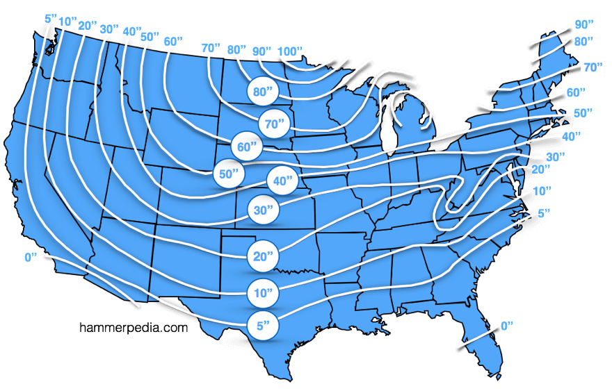
Scroll below the map for even more detailed information.
Source: U.S. Department of Commerce
Click Below for a detailed State Frost Line Map:
Missouri
Montana
Nebraska
Nevada
New Hampshire
New Jersey
New Mexico
New York
North Carolina
North Dakota
Ohio
Oklahoma
Oregon
Pennsylvania
Rhode Island
South Carolina
South Dakota
Tennessee
Texas
Utah
Vermont
Virginia
Washington
West Virginia
Wisconsin
Wyoming